Kargil Dras Corridor Travel Guide and Frontier Villages Narrative
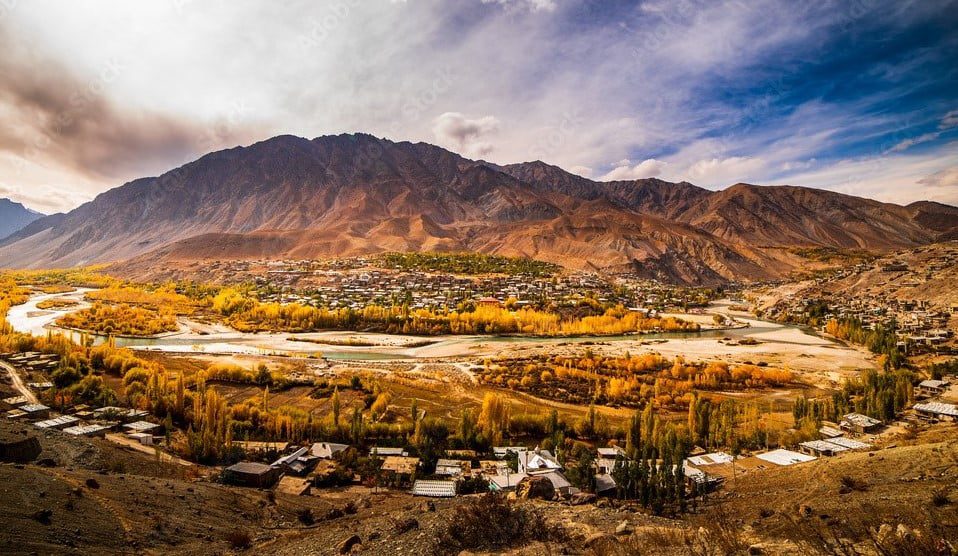
Where the Road Learns to Breathe Between Two Skies By Declan P. O’Connor I. Opening: Entering a Corridor Shaped by Wind, Memory, and Borderlines The First Turn Beyond Kargil Town For many European travelers, Kargil has long been a name borrowed from headlines and half-remembered news footage. Out here, beyond the last cluster of tyre shops, that reputation softens, reshaped by the sight of laundry lines on flat rooftops, the call of children following a cricket ball down a lane, the patient tilt of donkeys learning the shape of the road. The Kargil–Dras frontier corridor is not a destination in the conventional sense; it is a lived-in passage, a chain of communities that happen to sit near borders and battlefields but continue to prioritize crops, schooling and marriages. What awaits you is not a museum of conflict but a series of villages that have learned to keep going anyway, stitching ordinary days into an extraordinary landscape. Crossing that first invisible line beyond town, you are not just changing altitude; you are entering a place where the road itself is an introduction. The Frontier as a Living Landscape The phrase “frontier corridor” can sound abstract, like a line on a map argued over in distant capitals. In reality, the Kargil–Dras frontier corridor is thick with life: smoke rising from kitchen chimneys, prayer flags stiff with frost, flocks of sheep pushing pebbles down the slope as they move, and soldiers posted on ridgelines that most of us will never climb. It is a landscape where memory is not confined to memorials, but embedded in the terraces, in the weather-beaten faces of people who have watched the road change from mule track to highway. The frontier here is not only geopolitical; it is climatic, cultural and emotional, the place where green fields concede to cold desert, and where the idea of home must contend with snowdrifts and history. In the Kargil–Dras frontier corridor, the map in your hand is always incomplete; the real contours lie in the stories people are willing to tell you over tea. As you move from Kargil towards Dras and eventually to the high gate of Zoji La, the corridor continually rearranges itself. One hour the mountains are close and severe, the next they open just enough to reveal a village wrapped in orchards and stone. It is easy to think of such a place only in terms of risk and hardship, but that would miss the quieter truth. Life here is not an act of stoic suffering; it is a practiced negotiation between what the mountains allow and what human beings insist on building anyway. The Kargil–Dras frontier corridor is therefore not just scenery on the Srinagar–Leh road. It is a living experiment in how communities can remain rooted in a place that outsiders still misread as merely strategic. II. Kargil: A Town Where Continents and Centuries Meet A River Town with Unexpected Warmth Kargil, at first glance, looks like a junction, a necessary overnight stop on the long run between Srinagar and Leh. Look a little longer, though, and you begin to notice how the town draws its personality from the Suru River cutting through it, from the bridges that knit one bank to the other, from the way the bazaar tilts towards the water as if for reassurance. In the early evening, when shop shutters rattle and the last school buses grind uphill, the town feels less like a waystation and more like a riverine organism, breathing in time with the current below. This is where many journeys into the Kargil–Dras frontier corridor begin, with a pot of tea on a guesthouse balcony and the low hum of traffic trying to decide whether it belongs to Kashmir or Ladakh. For a European traveler used to neat historical districts and signposted heritage trails, Kargil can be disorienting in the best possible way. Layers of history are present but not curated: caravan pasts hinted at in old warehouses, Central Asian trade routes remembered in family stories rather than plaques, religious traditions woven into the pattern of daily errands rather than set aside in a museum. You might wander past a bakery where flatbread is slapped against the walls of a clay oven, then turn a corner to see schoolchildren in modern uniforms scrolling on their phones. The town’s role as the informal capital of this stretch of the Kargil–Dras frontier corridor means that it holds together diverse influences: Shia processions, Sunni mosques, Buddhist families from surrounding villages, and traders who have learned to translate prices in several languages. What emerges is not a picture-perfect destination, but a working town that quietly insists you take it on its own terms. The Stories Stored in Kargil’s Ridges Kargil’s ridgelines are not just natural defences; they are memory banks. On one side lie the road and river, on the other the smaller paths that climb towards hamlets, shrines and seasonal pastures. From almost any rooftop, you can look up and see what appears to be emptiness, only to discover that those apparently bare slopes host bunkers, watch posts and the ghost traces of older routes. Before national borders hardened and the Kargil–Dras frontier corridor became a phrase in security briefings, these valleys connected through trade and marriage. The road to Skardu, now cut by politics, once carried salt, wool and stories between communities that still share surnames. Spending a day in Kargil before following the corridor towards Hundurman or Dras offers more than just acclimatization. It grants you time to listen. Hoteliers will tell you about winters when snow closed the highway for weeks, forcing residents to improvise everything from fresh vegetables to medicine. Taxi drivers can point out slopes where their fathers walked with pack animals instead of engines. Young people, scrolling through global news on patchy networks, are just as capable of holding a conversation about football as they are about the latest landslide on the highway. The Kargil–Dras frontier corridor begins here, in a town that has learned to be both guardian and host, where hard edges in the collective memory are softened by the daily routine of getting children to school and ensuring the bread comes out of the oven on time. III. Hundurman and Hardass: Life at the Edge of Maps Hundurman Broq and the Line Where Maps Go Quiet If you follow a spur road from Kargil towards the Line of Control, the modern map begins to shade itself in grey. Somewhere above the river’s bend, stone houses cling to a slope that seems too steep to support them. This is Hundurman Broq, a village whose story is told as much through what has been left behind as through what remains inhabited. Walking through its narrow lanes, you move between homes now serving as a kind of open-air archive: rooms frozen in the middle of ordinary tasks, cupboards with crockery, schoolbooks, and clothing that suggest families departed in haste. It is here, on the edge of the Kargil–Dras frontier corridor, that you begin to understand how borders can be redrawn without a single stone in a village wall moving. For visitors, Hundurman offers neither spectacle nor comfort in the usual sense. What it offers instead is perspective. It asks you to imagine what it means to wake up one morning and discover that the line on the map has shifted, altering your citizenship without your consent. The current residents, settled just beyond the old cluster of houses, are careful about how they narrate this history, balancing pain with a matter-of-fact resilience. You might be shown a room that still holds a family’s belongings from before the partitioning of the valley, then invited for tea in a new home looking over the same river. The Kargil–Dras frontier corridor can seem abstract until you stand here and realize that “frontier” is not a general noun but a specific experience, lived by people who have had to accommodate both soldiers and tourists in their vocabulary of survival. Hardass: A Village Strung Along the River and the Road Return to the main highway and continue east, and the village of Hardass appears almost as an afterthought along the river’s curve, houses and fields strung between rock and tarmac. It is easy to drive past, assuming it is just another roadside settlement, but that would miss the subtle choreography at work. Terraced fields adjust themselves to both gravity and road access, children learn to judge the timing of passing trucks before sprinting across, and families design their days around both the sun and the bus schedule. Here the Kargil–Dras frontier corridor looks less like a grand strategic zone and more like a long, linear village, stitched together by irrigation channels and power lines. Spend a little time walking in Hardass and its quiet complexity emerges. Behind the row of buildings nearest the highway, narrow alleys lead to courtyards where women sort apricots or hang laundry, where livestock are coaxed into shaded pens, and where elderly men sit against a wall, following the news on a radio. The river below carries meltwater from glaciers you cannot see, while above, unmarked paths lead to grazing lands where shepherds still read the weather more accurately than any smartphone app. Hardass is one of those places where the Kargil–Dras frontier corridor feels intimately domestic: a place where international lines and military convoys are part of the backdrop, but where the pressing concerns are more immediate—whether the harvest will be good, whether the school will get a new teacher, whether the next winter will be kind or cruel. IV. Chanigound and Kaksar: Villages Listening to the Hills Chanigound: Everyday Life Under Watchful Ridges Further along the highway, the village of Chanigound sits in a bowl of land that feels both sheltered and scrutinized. The ridges around it rise quickly, folding into each other like the shoulders of giants interrupted mid-conversation. Somewhere up there, out of sight, are vantage points and posts; d
source https://lifeontheplanetladakh.com/blog/kargil-dras-corridor-guide/


Comments
Post a Comment